Capital Crescent Trail: Temporary Travel Lane, Trail Detours, and Parking Restrictions

(Washington, DC) –As a part of DC Water’s Potomac River Tunnel Project, temporary traffic lane closures, trail detours, and parking restrictions will extend from Water Street Northwest to the Capital Crescent Trail. The work to identify underground utilities will move to the Capital Crescent Trail on or about Friday, October 18, 2024, after completion of utility investigations on Water Street Northwest. Temporary closures are necessary to ensure the safety of pedestrians, bicyclists, motorists, and workers during the investigation process.
The contractor will use the potholing method to investigate the locations of underground utilities in preparation for constructing the Potomac River Tunnel (PRT). DC Water plans to construct a diversion facility at this site, including a diversion chamber, an approach channel, a drop shaft, and other structures to direct the flows from the existing combined sewer overflows (CSO) into the tunnel.
DC Water’s contractor began working on Water Street Northwest today as the first phase of the utility investigation. Work on the Capital Crescent Trail will be completed separately as part of a phased approach to minimize the impacts.
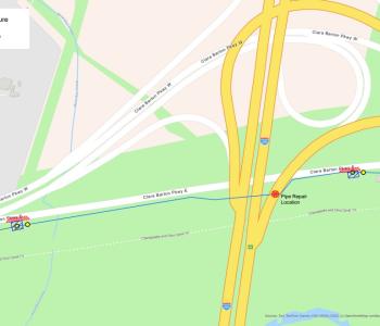
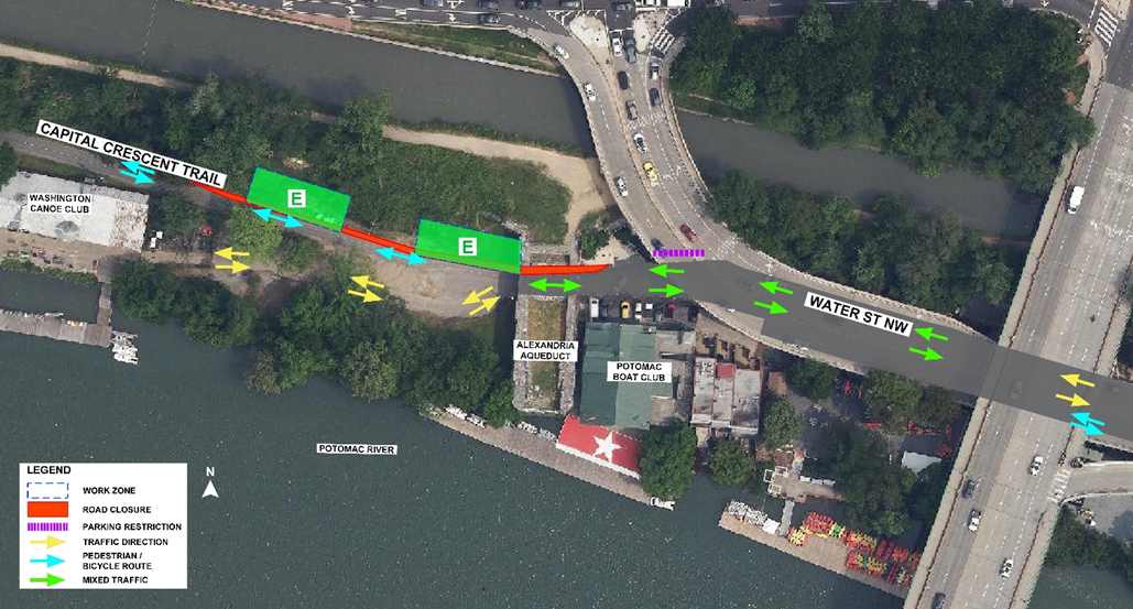
The map below shows the locations of the utility investigation areas. Work is estimated to take 3-5 days, pending inclement weather. Detours will be in effect on weekdays during work hours. The site will be restored when the work is completed. Maps B through E below represent the phases of the job and potholing locations. Details can be found in individual maps below.
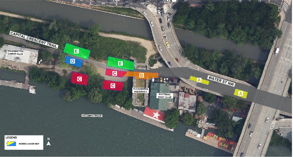
Capital Crescent Trail Work Details
- Time: Monday – Friday from 7:00 am – 7:00 pm
- Location: 3500 block of Water Street, NW and Capital Crescent Trail
- A flagger will assist pedestrians, bicyclists, and motorists through the work zone.
- Traffic Pattern Changes and Pedestrian Detours:
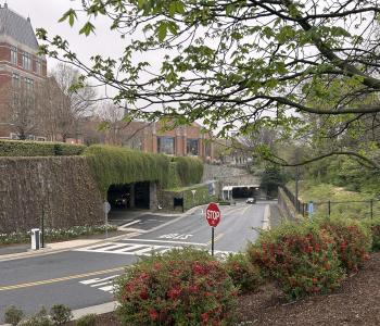
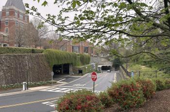
- Portions of a travel/trail lane under the Alexandria Aqueduct and along the Capital Crescent Trail will be temporarily closed. Trail access for pedestrians and bicyclists and access to the Washington Canoe Club will be maintained.
- Parking will be restricted on Water Street Northwest near work zones as noted by the purple markings on the map below.
- See the maps below for specific details for each phase.
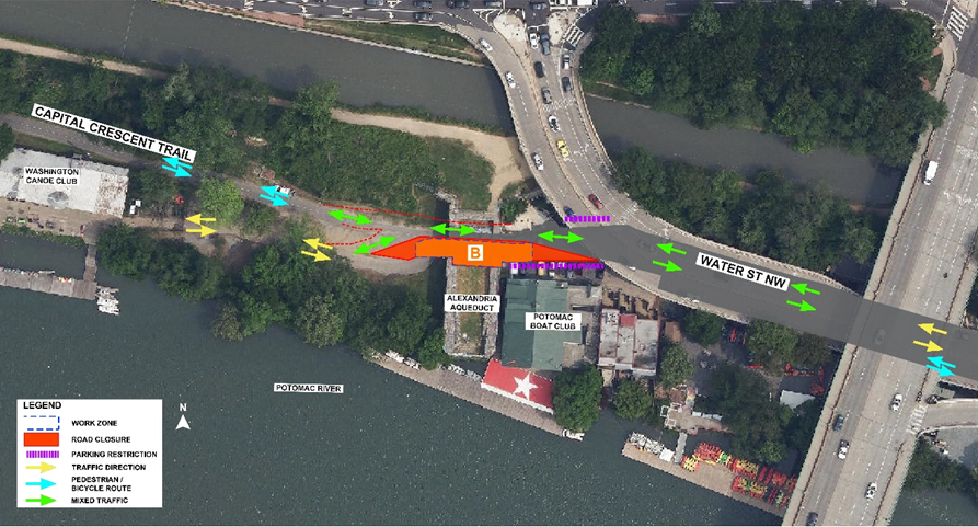
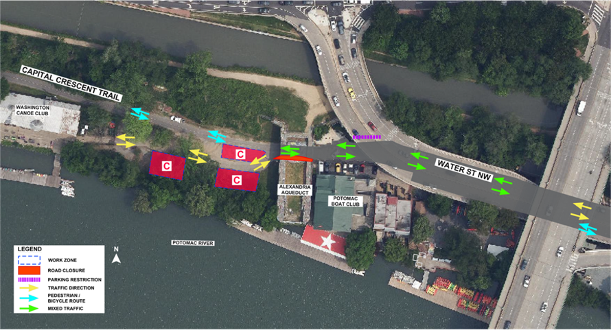
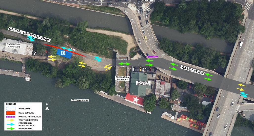
Important Information
- Commuters and pedestrians are advised to follow signage and flagging personnel directing them through the temporary closures.
- Please plan your travel routes accordingly and anticipate delays. Traffic control measures will be in place to guide motorists safely through the area.
Project Details
The Potomac River Tunnel is the next major phase of the DC Clean Rivers Project. The project consists of a large-diameter deep sewer tunnel, diversion facilities, drop shafts, and support structures to capture flows from existing CSOs along the Potomac River and convey them to the Blue Plains Advanced Wastewater Treatment Plant. The project is needed to reduce CSOs that contribute to water quality impairment of the Potomac River and ultimately the Chesapeake Bay; and to comply with the 2005 Federal Consent Decree entered by DC Water, the District of Columbia, the US Environmental Protection Agency, and the US Department of Justice, as amended in January 2016.
CSO outfalls release overflows into the Potomac River when rainfall exceeds the system’s capacity. This impacts water quality by increasing bacteria levels, contributing to low dissolved oxygen impacting aquatic life, and releasing trash into waterways. An estimated 654 million gallons of CSOs currently enter the Potomac River in a year of average rainfall. The proposed controls are estimated to reduce the volume of CSOs to the Potomac River by 93% and reduce their frequency from approximately 74 events to four events in a year of average rainfall.
For more information
Project Email: dcpotomacrivertunnel@dcwater.com
Project Website: www.dcwater.com/prt
Project Hotline: 202-972-1388
DC Water 24-hour Emergency: 202-612-3400


