IBM and DC WASA Flow Technology into Washington DCs Water and Sewer System
The District of Columbia Water and Sewer Authority (DC WASA) and IBM (NYSE: IBM) are working together to modernize the management of the aging water and sewer infrastructure hidden beneath the nations capital. The sprawling infrastructure includes hundreds of thousands of assets such as water distribution pipes, valves, public fire hydrants, collection pipes, man holes and water meters.
IBMs Global Business Services and Research arms have started a new collaboration with DC WASA to integrate advanced analytics with asset management software from IBM and a mapping application from ESRI, an IBM Business Partner. The availability of real time, map-based information and geo-analytics will help DC WASA engineers identify potential problems before they occur. This can be done by analyzing an enormous amount of data and uncovering patterns related to weather conditions, water use and hundreds of other variables.
The work of water relies heavily on our ability to monitor our infrastructure, said George S. Hawkins, General Manager of DC WASA. We can now manage almost every component from central, computer-based systems. Our collaboration with IBM will help us streamline our workload and serve our customers better.
The new preventative measures, including converting to automated meter readers, have substantially reduced billing-related customer calls. A future benefit of the project is that it will enable dispatchers to deploy crews based on where they are working and what areas need service, streamlining the workload and improving the customer experience.
The system will also enable DC WASA to share and exchange data both internally for planning purposes and externally to assist other agencies, such as sharing real-time status of the more than 9,000 public hydrants in DC with the DC Fire and Emergency Medical Services. Based on data from the IBM Maximo software, the hydrant status and water flow capacity of each hydrant can be mapped and seen by the fire department via Google Earth®. As firefighters are rushing to the scene, they will know in advance the level of water flow to expect out of the hydrants in the vicinity.
Our work with IBM has allowed our assets to communicate with us and were doing more than just listening, were taking action, said Mujib Lodhi, CIO of DC WASA. Using IBM software, were able to deploy our crews faster, which is key when theres water on the road or customers are without service. For day-to-day maintenance, the IBM software helps us to coordinate and plan our crews weeks ahead so we can work much more efficiently.
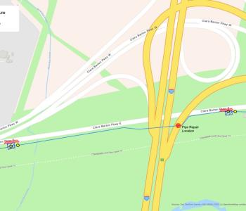
The system, which dates back to the 1800s, had been maintained with paper records, which meant engineers had to go through paper files to find the status of individual assets. Now, with their enterprise asset management system, DC WASA engineers can see a detailed map showing the location and condition of each asset at any given point in time with just a push of a button.
In cities like our nations capital, water management systems date back more than one hundred years, yet now serve millions of residents and visitors, said Sharon Nunes, vice president, Big Green Innovations, IBM. DC Water and Sewer Authority stands out because they understand this and are willing to bring about significant change in the way they work in order to more intelligently manage this critical resource.
DC WASA uses IBMs asset management software to manage: all the wastewater treatment equipment, the water and sewer infrastructure at the Departments of Water and Sewer Services, the water quality issues maintained by the Water Quality Division, and for permit plan reviews and developer permitting.
DC WASAs overall Enterprise Asset Management System is a combination of IBM Tivoli Maximo Enterprise Asset Management software and ESRI ArcGIS enterprise GIS (Geographic Information System) software.
# # #


